


GTVe J1

PhilippeC54
User
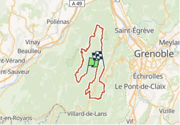

Length
58 km

Max alt
1714 m

Uphill gradient
1865 m
Km-Effort
82 km

Min alt
971 m

Downhill gradient
1686 m
Boucle
No
Creation date :
2022-06-28 06:52:43.629
Updated on :
2022-06-28 15:20:50.143
5h22
Difficulty : Very difficult

FREE GPS app for hiking
 SityTrail
IGN / Geographical institutes
SityTrail Plus
The world is yours!
About
Trail Mountain bike of 58 km to be discovered at Auvergne-Rhône-Alpes, Isère, Autrans-Méaudre en Vercors. This trail is proposed by PhilippeC54.
Positioning
Country:
France
Region :
Auvergne-Rhône-Alpes
Department/Province :
Isère
Municipality :
Autrans-Méaudre en Vercors
Location:
Méaudre
Start:(Dec)
Start:(UTM)
700433 ; 5002580 (31T) N.
Comments